|
|||
|
|
|
||
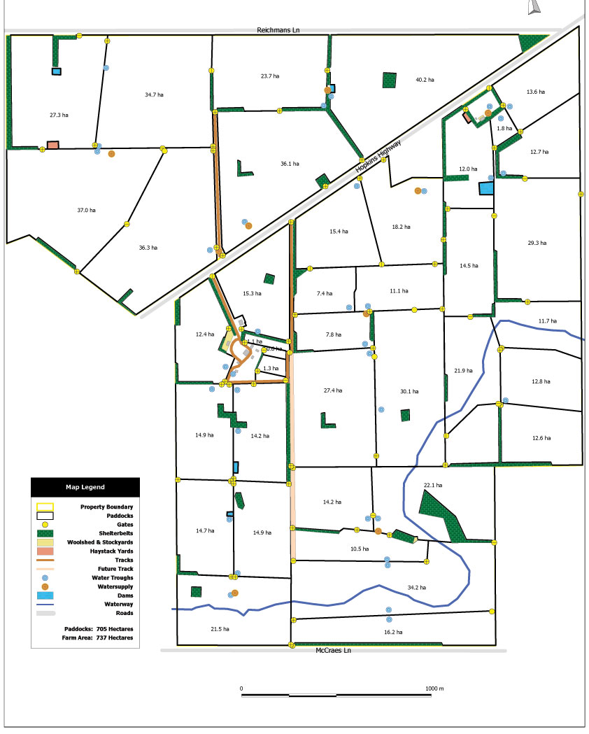
Farm PlanningEnProve can provide you with the aerial
imagery and mapping tools to create a whole farm plan. This tool can
be used to better manage paddocks and crops, more accurately manage
inputs and create informed long term production decisions. EnProve has a number of tools at your disposal to assist you withy your farm decisions
Contacts us to help you decide which tool will be the greatest benefit your farming enterprise from now into the future. |
|||
 |
EnProve Ag & Environment Phone 0448 866 205 Email:Enprove Warrnambool Victoria Australia |
||
| Home Nutrient Management Effluent Management Soil Testing Effluent Testing Soil Agronomy Nutrient Mapping About Us | |||